
library(foreign)
library(rworldmap)
library(dplyr)
Mapping Islam
I wanted to see how much Islam has spread into the Middle East and Europe over the last 100 years. The Association for Religion Data Archives just added a terrific dataset that has a lot of historical data regarding the world’s religious demography. The title is: U.S. Religion Census: Religious Congregations and Membership Study, 2010. A link to the dataset is here.
states <- read.dta("D:/religstates.dta", convert.factors = FALSE)The syntax to create the map is below:
states1900 <- subset(states, year == 1900)
gtdMap1900 <- joinCountryData2Map( states1900,
nameJoinColumn="abbrev",
joinCode="ISO3" )
## 80 codes from your data successfully matched countries in the map
## 107 codes from your data failed to match with a country code in the map
## 163 codes from the map weren't represented in your datamapCountryData( gtdMap1900,
nameColumnToPlot='muspct',
catMethod='fixedWidth',
numCats=9, mapTitle='Muslim Percentage in 1900', missingCountryCol= 'white', oceanCol = 'lightblue', mapRegion = 'eurasia' )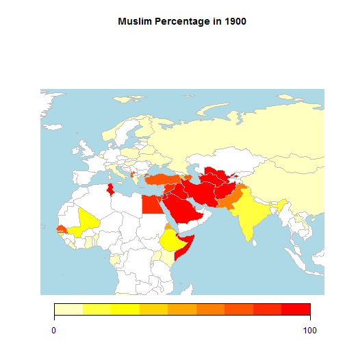
I repeated this syntax for 1910, 1920, etc. to 2010.
## 81 codes from your data successfully matched countries in the map
## 108 codes from your data failed to match with a country code in the map
## 162 codes from the map weren't represented in your data
## 82 codes from your data successfully matched countries in the map
## 103 codes from your data failed to match with a country code in the map
## 161 codes from the map weren't represented in your data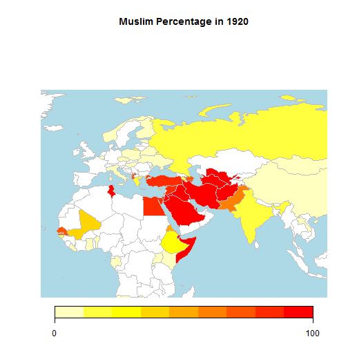
## 82 codes from your data successfully matched countries in the map
## 104 codes from your data failed to match with a country code in the map
## 161 codes from the map weren't represented in your data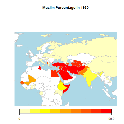
## 82 codes from your data successfully matched countries in the map
## 105 codes from your data failed to match with a country code in the map
## 161 codes from the map weren't represented in your data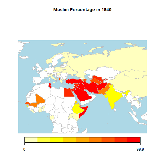
## 81 codes from your data successfully matched countries in the map
## 110 codes from your data failed to match with a country code in the map
## 162 codes from the map weren't represented in your data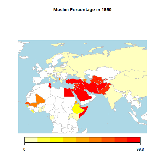
## 81 codes from your data successfully matched countries in the map
## 112 codes from your data failed to match with a country code in the map
## 162 codes from the map weren't represented in your data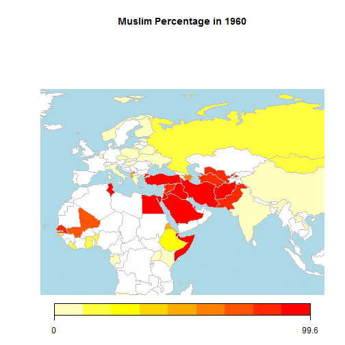
## 81 codes from your data successfully matched countries in the map
## 109 codes from your data failed to match with a country code in the map
## 162 codes from the map weren't represented in your data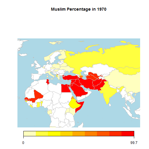
## 81 codes from your data successfully matched countries in the map
## 107 codes from your data failed to match with a country code in the map
## 162 codes from the map weren't represented in your data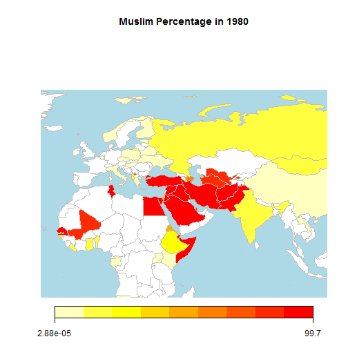
## 82 codes from your data successfully matched countries in the map
## 104 codes from your data failed to match with a country code in the map
## 161 codes from the map weren't represented in your data
## 81 codes from your data successfully matched countries in the map
## 104 codes from your data failed to match with a country code in the map
## 162 codes from the map weren't represented in your data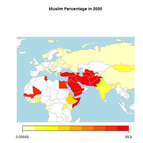
I took those 11 images and used an online tool to create an animated gif. That website is GifMaker
A final version of the animated gif can be found at IMGUR